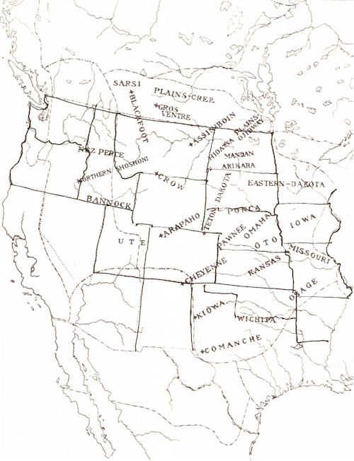
The ranges for the various tribes are approximately indicated by the positions and extents of their respective names. As a rule, these tribes did not respect definite boundaries to their ranges, each tribe claiming certain camping places, but otherwise hunting and roaming where it pleased. The typical Plains tribes are designated by a star and range north and south across the area. To the east of them are the tribes practicing some agriculture, perhaps in imitation of the Woodland tribes. On the west are a few tribes whose position is uncertain; hence, the boundary for the culture area has been drawn through their range, thus giving them an intermediate position.


