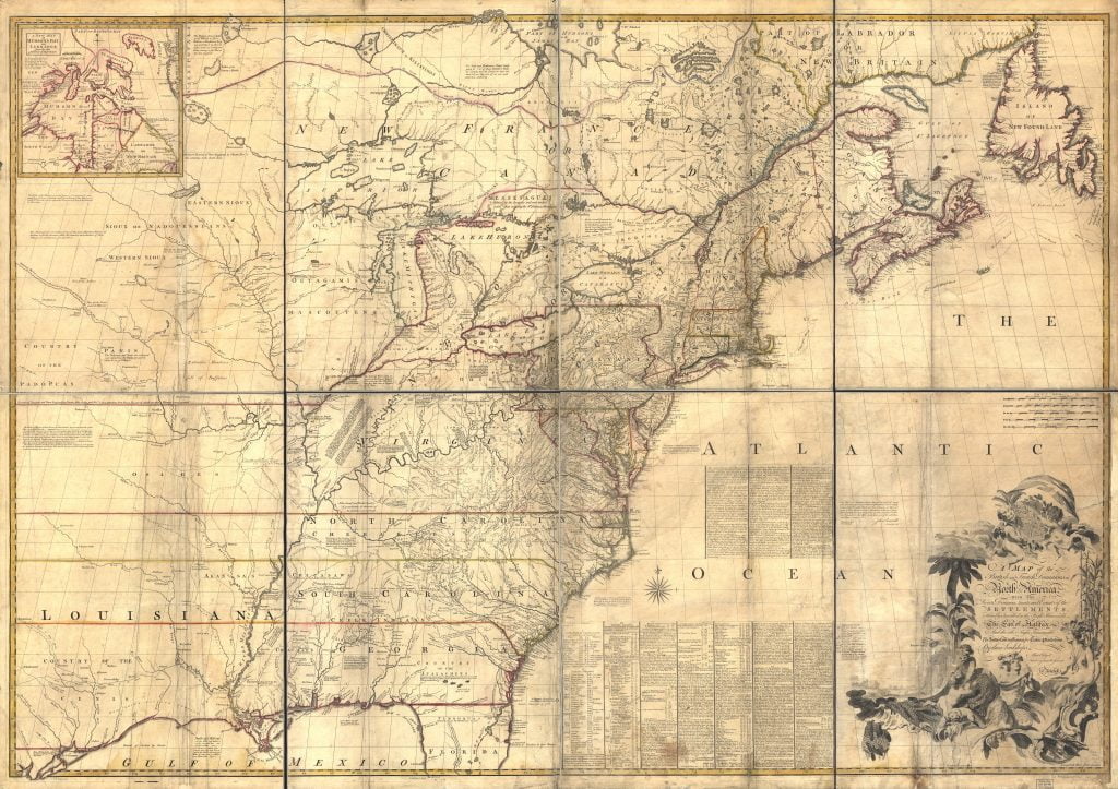
This is a very large file (37MB) and will take some time to download!
In 1755 John Mitchell produced a large map of what was known at that time of the Map of the British and French Dominions. Produced in 8 sheets, this map when laid out covered a space roughly equal to 6.5ft by 4.5 ft.
John Mitchell created this map by researching and looking at previously published maps and manuscripts. While fraught with obvious bias towards English imperial claims to America, by minimizing the claims of the French and Spanish, this map has still reached notoriety in it’s authenticity and accuracy…
The maps greatest reference was when it was used to set the boundaries in the peace treaty that ended the American Revolution.
Map Transcription
After the first drawing of this map in 1750, it was again corrected and improved, before it was published, and I have since ta
ken Care to procure & examine all the information I could get, in order to render it as correct & usefull as possible; which has given occasion to this Second Edition of it, in which I have likewise inserted all the Observations I believe we have for the Geography of N. America, since I find them grossly misrepresented by others.
The Foundation of this Map is the several Manuscript Maps, Charts & Surveys that have been lately made of our Colonies, which represent most Places from the Ocean to the Missisipi. But in order to know the true Situation of those Places, we must have their Latitudes & Longitudes, which are of more Consequence in a general Map, than their bare Shape or Figure, which we only find represented in our Draughts & Surveys. But after having consulted all the Observations I believe that we have, I found the true Situation, or Latitude & Longitude, of many Places was undetermined or uncertain; & that we had no Accounts of them, but what might be found in the Journals of our Ships of War kept in the Admiralty Office; which I had Recourse to for that reason, and have extracted from them whatever relates to our purposem which are the chief Source of the Corrections & observations here inserted.
Since the Publication of this Map likewise I have examined & compared with other Accounts, the Observations of Mr. Chabert; which were not made when our Map was first drawn, nor known in England till after it was published; so that we neither followed nor rejected them. From these Authorities we find but two Alteration necessary in our Map: 1. In the Latitude of Cape Race: 2. In the Longitude of Cape Sable. I. Cape Race was laid down in Lat. 46°.55′, from the Surveys of Capt. Gaudy & Durell, who make it in Lat 47°.2′, & 46°.57′; and the Observations of Bellin, which make it in 46°.50′. But by all the accounts in our Ships of War, confirmed by those of Chabert, it is in Lat 46°.30′, or 35′ at most; from which, and other Observations here inserted, we have corrected that and other parts of Newfoundland.
In the longitude of Cape Race, different Reckonings in our Ships from Cape Breton, Canso, & Boston, differ 2 Degrees (on Account of the Currents), and more than Reckonings from Europe.
Native American Research
Researchers of Native American tribes can use this map as a place locator for Indian towns, as a tribal identifier, and for it’s identity of some Indian trails. Known irregularities or inaccuracies as pertaining to Native American research are:
- Iroquios Territory
Mitchell expanded the existing territory of the Iroquois Tribe, either from using an older reference of their territory (by 1755 the area encompassed by the Iroquois had been greatly depleted) or for the purpose of reducing the claim by the French for that same land.


