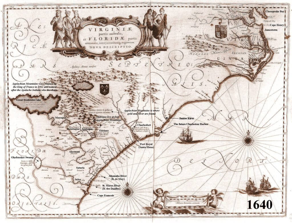
The Kingdom of France continued to claim what is now Georgia and South Carolina even though there is no record of any French settlements in the region after 1568. By issuing this map, the King of France also recognized the legitimacy of the Virginia Colony. The coat of arms of Great Britain are placed upon that section of North America. By this time, France had also established permanent settlements in Quebec and was claiming all of present day Canada, except for Newfoundland.
This map is the first one to provide an accurate description of the South Atlantic Coast. It includes the Virginia Colony, and the various tribes living around the Chesapeake Bay. The Altamaha River is named the May River. The St. Marys River is named the Dolphin River. The village of Seloy, where the Spanish set up a base camp before attacking Fort Caroline, is in present day Camden County, GA near St. Marys. This is also the first map to correctly show the St. Marys River originating in the Okefenokee Swamp.


